
Certified UAV Drone Services
Data Analysis & Media Group
UAV Forensics - Thermal Imaging - Cinematography - Aerial Mapping - Real Estate
Fully Insured, Multiple FAA Clearances - New York City Wide Area Blanket - Class Bravo and Night Waiver
Certified Insured UAV Drone Services from cinematography to engineering, architecture, forensic inspections, surveying, mapping training and more. Upperairvision Upperaerialvision
New Jersey - New York - Pennsylvania - Connecticut - Florida


Facade Inspections
Engineering
Architecture
Antenna Tower Inspections
FAA Night Waiver Approved
Chimney Tower
UAV Inspections
Generation Station
Power Plant
Cooling Towers
UAV Inspections
Railroads
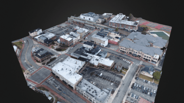
3D Accurate Aerial Photogrammetry
UAV Drone Topographical Mapping
Phillipsburg, New Jersey
Certifications

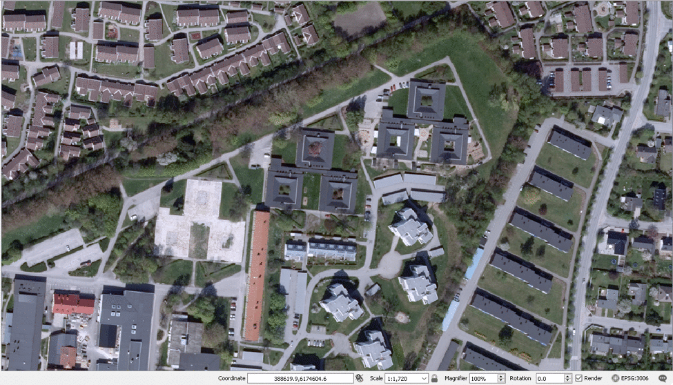
GIS Mapping w/ Aeropoints GPS Correction
Geographic Information System Mapping
Service Description
With centimeter accurate GPS corrections, create precision contour maps and define boundaries for large scale projects. Quick turnaround time analysis data of X Y Z values on both terrain and structures. Call for information on how we can help on your project. Time savings. Up to ten precision points per hour.
Contact Details
+ 7329087309
info@UpperAerialVision.com
49 Rose Street, Phillipsburg, NJ, USA